AGRICULTURE
To add a base station to the project which is already in GPB format, navigate to:
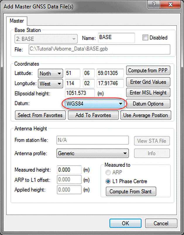
File | Add Master File(s)
When loading a master file, the coordinates that appear in the master coordinate dialog may come from two different sources. If loading data converted from RINEX, as is the case when obtaining base station data through the Download Service Data Utility, the coordinates that appear initially are scanned from the RINEX header. The coordinates provided in the RINEX header may be precise or approximate; this will depend on the individual RINEX data provider.
If loading base station data converted from any other source, the coordinates that appear initially are likely averaged from the unprocessed position records decoded in the raw GNSS data file. The accuracy of this position is typically no better than approximately 2 m horizontally and 5 m vertically.
Regardless of the source of base station data, it is important that accurate coordinates are loaded to avoid any biases in a processed solution. In differential processing, a vector is solved between the base station antenna and the remote antenna. Any error in the base station position is directly transmitted to the remote position. When adding a base station, it is recommended to use the Compute from PPP feature to help improve the approximate position of the station.
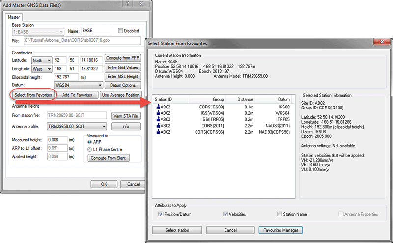
Coordinates for select base station networks, such as CORS and IGN, are regularly maintained and accessible through the favorites. To assist in loading precise coordinates, it is recommended that service station coordinates be selected from the favorites list through the “Select from Favorites” option. A user should consider the “Attributes to Apply” when selecting the desired station; an attribute such as velocities can make a significant impact on position as annual drift corrections are applied from the epoch year (ie. 2005) to the day for which the station is downloaded.
The Compute from PPP option can also be used to easily check or survey base station data using GrafNav's Precise Point Processor. When using this option, the difference between the loaded and computed coordinates is displayed.
Note: PPP accuracy is largely dependent on the length of the survey.
The datum which is selected when adding a master file will also determine the processing datum. Coordinates can be exported to other datum through the Export Wizard. It is important that the datum is consistent across all master files in multi-base applications as the base stations should have the best possible relative accuracy to mitigate solution biases.