
AGRICULTURE
For many applications, such as airborne survey, corrected GNSS positions are not required in real-time. For these applications, raw GNSS satellite measurements are collected and stored for processing post-mission.
During post-processing, base station data can be used from one or more GNSS receivers. Multi-base processing helps preserve high accuracy over large project areas, which is a common occurrence for aerial applications. Depending on the project’s proximity to a permanently operating GNSS network, base station data can often be freely downloaded, eliminating the need for establishing your own base station(s). Moreover, it is possible to process without any base station data through PPP, which utilises downloaded precise clock and ephemeris data.
Post-processing applications offer a great deal of flexibility. Applications can involve stationary or moving base stations, and some support integration with customer or third-party software modules. Post-processing applications may be designed to run on personal computers that are accessible through simple-to-use graphical user interfaces.
In the example shown in Figure 45, the route taken by the vehicle is shown on the left side of the screen and measurements recorded during the mission, such as velocity, are resolved into horizontal and vertical components in the right side.
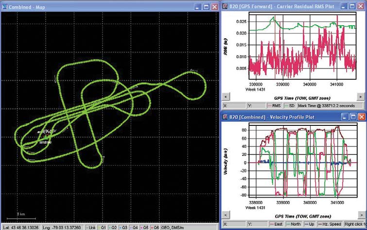
Post-processing generally results in a more accurate, comprehensive solution than is possible in real-time.


