
AGRICULTURE
A commonly used technique for improving GNSS performance is DGNSS, which is illustrated in Figure 41.
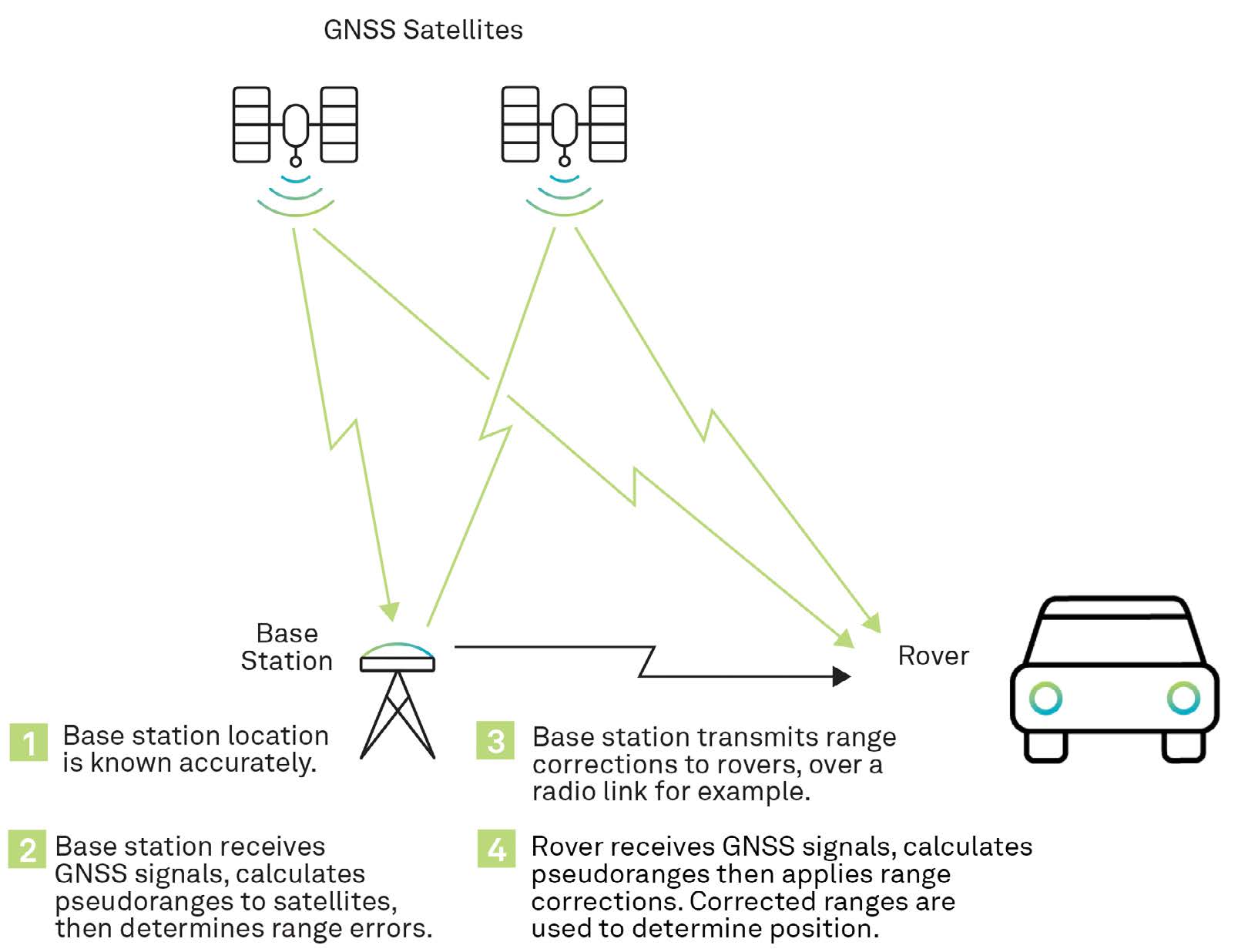
In DGNSS, the position of a fixed GNSS receiver, referred to as a base station, is determined to a high degree of accuracy using conventional surveying techniques. Then, the base station determines ranges to the GNSS satellites in view using:
The base station compares the surveyed position to the position calculated from the satellite ranges. Differences between the positions can be attributed to satellite ephemeris and clock errors, but mostly to errors associated with atmospheric delay. The base station uses the difference between the calculated and surveyed position to generate a correction message which it sends to other receivers (rovers). The rover receivers incorporate the corrections from the base station into their position calculations to improve position accuracy.
If corrections need to be applied in realtime, differential positioning requires both a data link between the base station and rovers and at least four GNSS satellites in view at both the base station and the rovers. The absolute accuracy of the rover’s computed position will depend on the absolute accuracy of the base station’s position.
Since GNSS satellites orbit high above the Earth (approx. 20,200 km or 12,550 miles), the propagation paths from the satellites to the base stations and rovers pass through similar atmospheric conditions, as long as the base station and rovers are not too far apart. DGNSS works very well with maximum separations of up to tens of kilometres or miles.


