AGRICULTURE

Weather forecasting plays a huge role in our daily lives. It helps us determine what to wear, when to leave the house and if we need to adjust our outdoor plans. But weather forecasting isn’t just a factor in our personal lives: It also impacts every segment of our society and economy in very tangible ways, influencing important decisions business leaders and public safety officials make every day.
“Earth Networks offers such customers the accurate weather-related information they need,” said Bill Callahan, vice president of federal programs at Earth Networks. The company operates weather and climate sensor networks all over the world, producing decision support products for end users. The systems use remote sensing techniques to detect total lightning, which greatly enhances severe storm identification, tracking and alerting.
Earth Networks’ products and services meet the safety, business continuity and information needs of government and commercial customers, including U.S. federal agencies, international hydro-meteorological services, state and local emergency managers, schools, sports/recreation teams and facilities, energy producers/transmitters, mining operations, airports/airlines, insurance companies and a variety of others.
By deploying weather stations on customer facilities, many in non-traditional locations throughout communities (the National Weather Service primarily operates stations at airports), Earth Networks collects and provides weather information from the places where people live, work and play.
“There’s only a limited number of airports and a lot more people, places and things for which having access to weather information is highly useful,” Callahan said. “The vast majority of the U.S. economy and those of other nations are very weather sensitive and these data are key to cost-effectively filling the data gaps in traditional observing networks.”
Moisture and latent heat are transferred in the atmosphere via water vapor, which is why it’s one of the most significant constituents of the Earth’s atmosphere. Water vapor is a greenhouse gas that plays a critical role in the global hydrologic system, and is a key component in cloud formation, as well as the lower atmosphere’s chemistry. Despite its important role, we don’t know much about it. Water vapor moves rapidly as it redistributes energy through evaporation and condensation, often abruptly and over short distances—making it difficult to observe, especially during severe weather.
It also accounts for GPS signal delays, Callahan said.
“The vast majority of the signal delay in GPS frequency transmissions is caused by water vapor in the atmosphere,” he said. “Water vapor causes GPS signal delays ranging from near zero in very dry conditions to several decimeters in humid conditions. Water vapor is one of the most important constituents in the atmosphere. It absorbs and radiates heat and drives meteorological processes, but it is one of the least sampled. Given the fact that GPS can be used to characterize the water vapor induced signal delay at the millimetre-level, one can figure out how much water vapor is in a column of the atmosphere and leverage that in forecasting.”
In the late 1990s, NOAA’s Earth Systems Research Laboratory (ESRL) Global Systems Division developed a capability to use GPS signal delays to measure water vapor and set up a pseudo-operational network in 2002, Callahan said. By 2005, the data was being used in some NWP models. That was a start, but the technology wasn’t being used to its fullest potential.
Rather than move from the research to operational phase on their own, the team at NOAA decided to work with companies in the private sector that had developed similar technologies and could provide operational capability. That’s where Earth Networks and GPS Solutions came into play.
GPS Solutions had already created a system in Japan that generated similar information to what NOAA was using. The proven solution was more efficient than the one NOAA had developed, Callahan said, because it used more advanced technology.
“NOAA’s processing put out very solid results but its ability to scale was limited by the fact they were using older technology,” Callahan said. “It was originally developed in the late 90s, then refined in the early 2000s. Only marginal enhancements had been incorporated since, so it wasn’t optimized for current computing capacity.”
GPS Solutions and Earth Networks began working together in 2013 to demonstrate to NOAA that, together, they could create and manage an operational system to measure IPW. In 2016, the companies won a five-year contract to do just that and have already grown the network from 400 sites to 1,250, with plans for more expansion in the future. GPS Solutions’ expertise, combined with Earth Networks’ capabilities to integrate third-party sensors into its monitoring system configuration, their ability to host and monitor multitudes of networks, their strong relationships with federal agencies and their ability to deliver end-user customer support led to the perfect partnership between the two companies.
Before they were selected by NOAA, the companies went through what Callahan describes as a “vigorous beta testing period.”
“NOAA picked numerous regions throughout the U.S. within diverse climate regimes, the desert southwest, the warm/humid southeast, northern high plains—to look at the efficacy of the data we were providing,” Callahan said. “Not only were the data highly correlated, the system was better in many ways as it had the additional attributes of speed, high temporal frequency and scalability.”
GPS satellite radio signals slow down as they pass through the Earth’s atmosphere, delaying when the signal arrives. The delay originates from the ionosphere and the neutral atmosphere. Dual-frequency GPS receivers can correct for the delays caused by the ionosphere, but not delays from the neutral atmosphere as they are not frequency dependent. Those delays are caused by a mixture of dry gases and water vapor. The signal delays caused by water vapor in the troposphere can be estimated and used to retrieve the total column water vapor, also known as IPW.
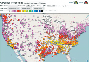
The network makes it possible to observe IPW with high horizontal resolution, high temporal resolution, high accuracy, long-term measurement stability and high reliability—in all weather conditions no matter the time of day. The continuous, independent observations are fed into weather forecast models. With access to these data, forecasters can better predict impactful weather events such as hurricanes and large storms.
Sites used for these purposes have a GPS receiver and many also have a co-located surface meteorological instrumentation package. GPS satellite observations are combined with GPS satellite orbit and Earth orientation parameters to estimate GPS signal delay, or Zenith Total Delay (ZTD). Signal delays are then combined with surface meteorological information to estimate total precipitable water. For sites without surface meteorology sensors, data from nearby ASOS (Automated Surface Observing Systems) or similar systems are used.
GPS total signal delay, GPS hydrostatic signal delay, GPS wet signal delay and the wet delay mapping function are among the methods used to compute precipitable water estimates and locate the water vapor through the GPS-IPW network. Precipitable water estimates, combined with data collected from Continuously Operating Reference Sites (CORS), such as surface temperature, surface pressure and mean-weighted surface temperature, are input into the model to improve forecasting.
The RTNet-Met software developed by GPS Solutions uses GPS and GNSS receivers to generate and deliver this information. It features two main components: Real Time Epoch Server (RTES) and RTNet. RTES reads GNSS data epochs from receivers and translates, compresses and makes them available to RTNet, which then processes the observations. The RTES/RTNet software runs in Earth Networks’ cloud-based data centers. The system produces accurate water vapor observations with low latency and 0.5-30 minute temporal resolution for assimilation in NWP models.
RTES offers a high compression rate and reliability, while RTNet processes GPS networks with high accuracy, carefully modeling anything that might influence GPS measurements. It also works with variance-covariance matrices, not just their baseline-related parts, to correctly handle measurement dependencies. While mainly designed for real-time applications, it also supports continuous near-real time processing and post-processing.
The RTNet-Met software can estimate a large number of parameter types, including the receiver and satellite clock corrections and parameters that characterize the ionospheric and tropospheric delays. It processes data in network mode or in single station Precise Point Positioning (PPP) mode (real-time or post-processing), and can resolve carrier phase ambiguities over a wide range of baseline lengths and in PPP mode.
The system and network will continue to grow, Callahan said. The global company already operates in more than 90 countries, and is expanding further internationally to establish more observational assets around the world.
With more than 10,000 weather stations across the globe, Earth Networks has many points of presence collecting data in real-time, Callahan said. “Deploying dual-frequency GPS receivers to those sites will facilitate the production of GPS-IPW information with a global footprint.
“Establishing a denser network of surfaced base dual-frequency receivers is one challenge for us. Density is important because of the weather component,” Callahan said. “The numerical weather prediction models are running at higher resolutions and the observational inputs or initial conditions need to be of greater density as well as get good results. There’s a correlation between the information that goes in and what comes out. The more information we have, the better forecasts and decisions we can make.”