AGRICULTURE
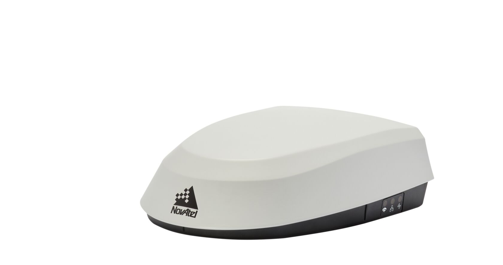
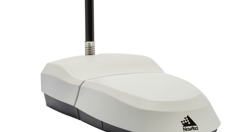
The SMART7 multi-frequency SMART Antenna combines a NovAtel OEM7 receiver and precision antenna in a durable and waterproof enclosure. Access to multiple GNSS signals allow for better satellite availability under variable terrain and environmental conditions. The SMART7 also receives L-Band signals to access world-wide correction signals provided by TerraStar.
Modern agriculture users need wireless solutions for tablets and smartphones. The SMART7-W includes Wi-Fi and an integrated NTRIP client for flexible connectivity with Wi-Fi and cellular gateways. The SMART7-I model adds Ethernet for easy connectivity to wired IP networks and devices and Precision Time Protocol (PTP) capability.
| System Type | Enclosed with Antenna | |
| General Info | Width | 192 |
| Length (mm) | 220 | |
| Height (mm) | 66 | |
| Weight (kg) | 1.1 | |
| Typical Power Consumption (W) | 4 | |
| Signal Tracking | GPS | L1, L2, L2C, L5 |
| GLONASS | L1, L2 | |
| Galileo | E1, E5a/b, E5 AltBOC | |
| BeiDou | B1l, B1C, B2l, B2a, B2b | |
| QZSS | L1, L2 | |
| SBAS | L1 | |
| L-Band (TerraStar) | ||
| Number of Com Ports | RS-232 | 3 |
| CAN Bus | 1 | |
| 1 PPS | 1 | |
| Ground Speed Output | 1 | |
| Wi-Fi | Optional | |
| Ethernet | Optional | |
| Performance | Accuracy | |
| Single Point L1/L2 | 1.2 m RMS | |
| SBAS | 60 cm RMS | |
| DGPS | 40 cm RMS | |
| TerraStar-C PRO | 2.0 cm RMS 2.5 cm 95% | |
| TerraStar-X | 2.0 cm RMS 2.5 cm 95% | |
| RTK | 2.5 cm + 2 ppm (95%) |
Major Feature |
SMART7 |
SMART7-W |
SMART7-I |
SMART7-S |
SMART7-SI |
| GLIDE | ✓ | ||||
| TerraStar Correction Services | Software Option and Subscription Required | ||||
| Terrain Compensation | - | Optional | Optional | - | - |
| SPAN | - | - | - | ✓ | ✓ |
| Wi-Fi | - | ✓ | ✓ | - | ✓ |
| Ethernet | - | - | ✓ | - | ✓ |
| Precision Time Protocol (PTP) | - | - | ✓ | - | ✓ |
| RELAY7 UHF Radio Adapter | Optional | ||||
Firmware that provides high precision attitude and accurate relative positioning information between two or more receivers in dynamic land, air and marine applications.
Smoothing algorithm for repeatable pass-to-pass accuracy.
The RTK rover radio module for SMART7 antennas.
Network Transport of RTCM via Internet Protocol (NTRIP) is an application level protocol used to stream GNSS differential correction data over the Internet.
STEADYLINE technology reduces position jumps that can occur when a GNSS receiver changes positioning modes.
Global and regional correction services ranging from 2 cm to 50 cm accuracy for land and airborne applications.