AGRICULTURE
Satellite based positioning provides the world's most precise location information. It is possible to acquire positioning anywhere in the world that GNSS satellite signals are available, any time of day, at data rates up to 100 Hz. Measurements can be generated in real time or processed post-mission to achieve the highest level of accuracy.
GNSS technology is most frequently used to:
Positioning information typically provided includes a horizontal domain (latitude/longitude or easting/northing) and a vertical domain (height).
GNSS position solutions are available in a wide range of accuracies. While the application of this technology is limitless, key applications include:
Location determination applications
Guidance applications
Real-time Standalone/Wide Area Positioning:
A single GNSS receiver operates individually or “standalone” to determine its location.
| Position Type | Tracked Satellite Frequency | Horizontal 1ơ RMS Accuracy+ (m) |
|
Single Point |
Single |
1.5 |
|
Single Point |
Dual |
1.2 |
|
Satellite Based Augmentation System* (SBAS) |
Single |
0.6 |
|
Dual |
40 cm |
|
|
Dual |
4 cm |
+Under ideal open sky environment. Solution accuracy is dependent on antenna selection.
*Region dependent.
1 Requires subscriptions to NovAtel Correction Services
Real Time Relative/Local Based Positioning:
Requires real time code or code and phase GNSS measurement corrections from a base/reference station(s) to be transferred to the GNSS receiver (in this case referred to as rover). Radio or network type communication data link equipment is required.
| Position Type | Tracked Satellite Frequency | Horizontal 1ơ RMS Accuracy+ (m) |
|
DGPS |
Single |
0.4 |
|
RTK |
Dual |
0.01+1 ppm |
+Under ideal open sky environment. Solution accuracy is dependent on antenna selection and external base/reference station(s) position accuracy.
Post-processed Positions:
When positioning measurements are not required in real time, GNSS data can be post-processed to enhance solution accuracy. Our GrafNav and Inertial Explorer® post-processing software takes advantage of both forward and backward data computations to generate the most accurate combined solution possible. Solution availability is enhanced and assessment of data quality under challenging environment can be optimized. Raw code and phase data captured from the GNSS receiver during the event is required.
| Solution Type | Other Required Input | Horizontal 1ơ RMS Accuracy+ (m) |
|
Differential GNSS~ |
External base/reference station raw code and phase GNSS data |
0.01+1 ppm† |
|
Precise Point Positioning (PPP) |
Precise satellite clock and precise satellite ephemeris data |
0.03-0.07‡ |
+Under ideal open sky environment. Solution accuracy is dependent on antenna selection.
~ Similar to the Relative/Local Based Positioning mentioned above, Differential GNSS solution
accuracy is dependent of external base/reference station(s) position accuracy.
† Dual frequency data and fixed solution.
‡With at least two hours of continuous, open sky, dual frequency data.
When choosing a positioning solution, consider the following needs of your application:
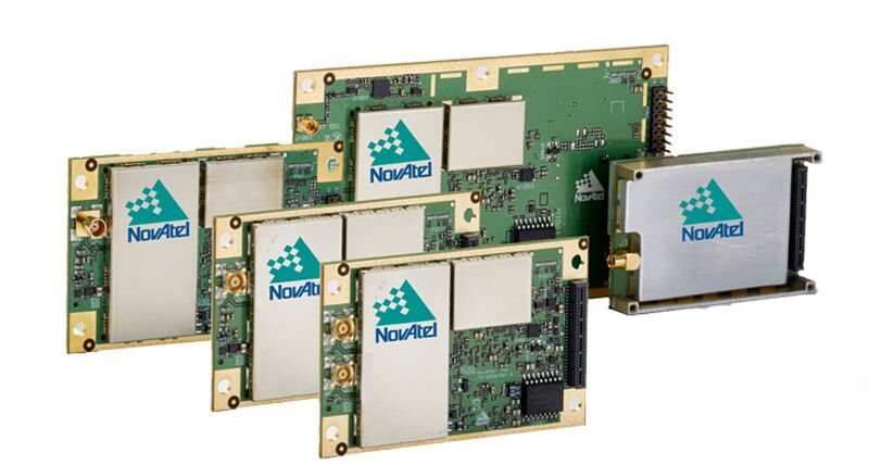
OEM board level and board + enclosure GNSS receiver options.
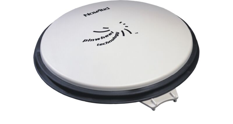
Performance of a choke ring antenna without the size and weight. Features high phase center stability and low phase center offset.