AGRICULTURE

Tailored for UAV markets and small area surveys, Inertial Explorer Xpress provides the same core processing and utilities as Inertial Explorer with simplified functions and streamlined workflows at a lower cost. Post-process data efficiently with centimetre-level position and attitude solutions compatible with LiDAR, camera and other sensor data. Xpress supports various third-party GNSS+INS products and generic data formats.
Differential GNSS, also known as post-processed kinematic (PPK), precise point positioning (PPP) and tightly coupled processing for GNSS+INS datasets are supported with reduced complexity and faster processing time for single base station projects. Xpress also verifies and performs quality analysis on your solution with plots relevant to your project.
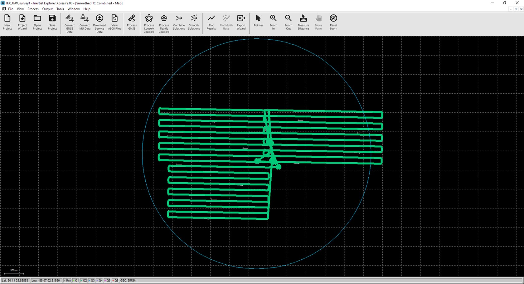
In Xpress, you can select a small area of GNSS+INS processed points within a centroid circle to export. The centroid circle encompasses a three-kilometre radius around the project centroid, an average of all non-stationary processed coordinates in the project.
TerraStar-NRT is a multi-constellation correction service that enables centimetre-level accuracy in post-processing without the need for a base station. High rate satellite clock and orbit products are uploaded to a NovAtel server every 15 minutes to allow for post-processing almost immediately after data collection. When used with the PPP-AR Engine with NovAtel receivers, it provides better horizontal accuracies for short duration surveys. A TerraStar-NRT license is available as a yearly subscription and must be activated in Waypoint Software through the local license manager to use.
Inertial Explorer SDK (Software Developers Kit) is a suite of tools that can be used standalone or embedded for GNSS/INS post-processing in enterprise software or processing workflow
A powerful, highly configurable processing engine that outputs the best possible static or kinematic GNSS accuracy using all available GNSS constellations and frequencies.
The flagship Waypoint software product, Inertial Explorer maximises the accuracy of your GNSS+INS trajectory post-mission with tightly coupled integration for generating...