AGRICULTURE

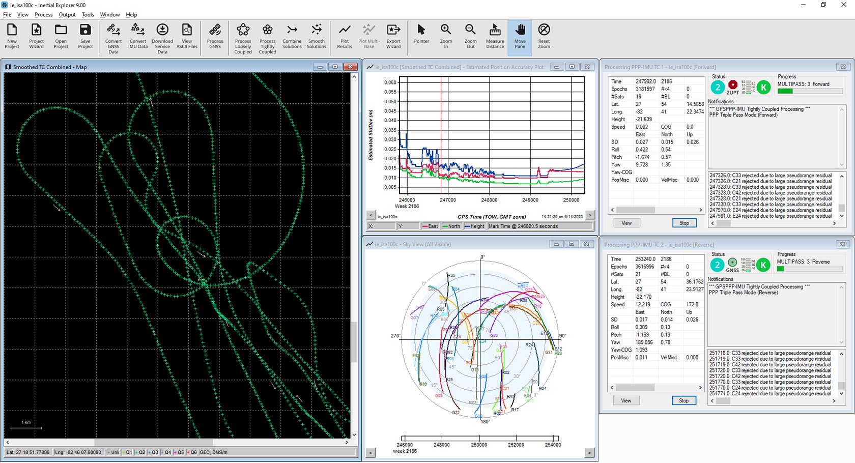
Inertial Explorer (IE) maximises the performance of your GNSS+INS hardware by processing and outputting a truth trajectory with the position, velocity and attitude accuracy your application requires. The tightly coupled integration of GNSS and inertial data delivers precise results, even when using lower-grade inertial sensors.
IE provides a source of truth for post-mission position, velocity and attitude trajectories for a range of applications, including mobile mapping, aerial and hydrographic surveying, R&D companies developing autonomous systems and post-processing-as-a-service integrators. With full support of major constellations, frequencies and GNSS corrections processing, IE ensures your data are reliably precise no matter where in the world you operate.
IE has built-in workflows to match your business and your expertise. A project wizard assists new GNSS+INS users with importing their data, processing and outputting with accurate quality control and across formats efficiently. Automated processing environment detection for aerial, ground vehicle, pedestrian and marine profiles allows appropriate processing settings to be used automatically to streamline your workflow, reduce your learning curve and start producing quality results quickly. For more experienced users, a wide range of processing configuration options are available to fully customise your workflows for your unique application.
Inertial Explorer supports loosely coupled and tightly coupled processing modes for integrating GNSS and inertial data. Learn more about GNSS+INS coupled systems in our Introduction to GNSS book here.
TerraStar-NRT is a multi-constellation correction service that enables centimetre-level accuracy in post-processing without the need for a base station. High rate satellite clock and orbit products are uploaded to a NovAtel server every 15 minutes to allow for post-processing almost immediately after data collection. When used with the PPP-AR Engine with NovAtel receivers, it provides better horizontal accuracies for short duration surveys. A TerraStar-NRT license is available as a yearly subscription and must be activated in Waypoint Software through the local license manager to use.
The Waypoint software development kit delivers complete control over the GrafNav and Inertial Explorer post-processing functions so you can customise and automate your workflows.
A powerful, highly configurable processing engine that outputs the best possible static or kinematic GNSS accuracy using all available GNSS constellations and frequencies.
A post-processing package streamlined for static GNSS-only data and includes a batch static baseline processor and network adjustment package.